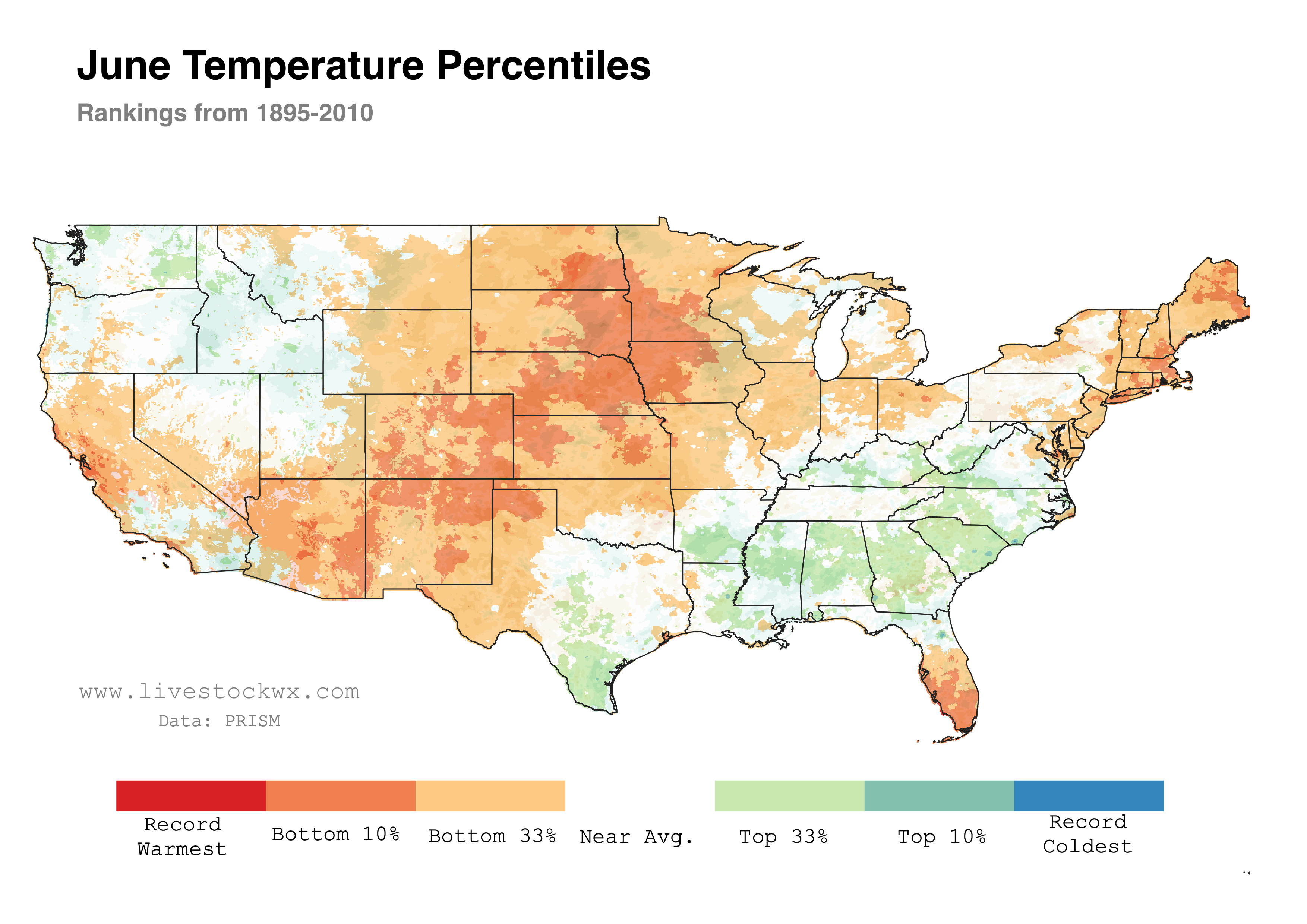
The June temperature and precipitation stats are out. Over the last month temperatures (map immediately below) have been above normal for most of the central part of the Country. Temperatures were particularly warm, and in the top 10 percentile, along an axis going from Arizona to Minnesota.
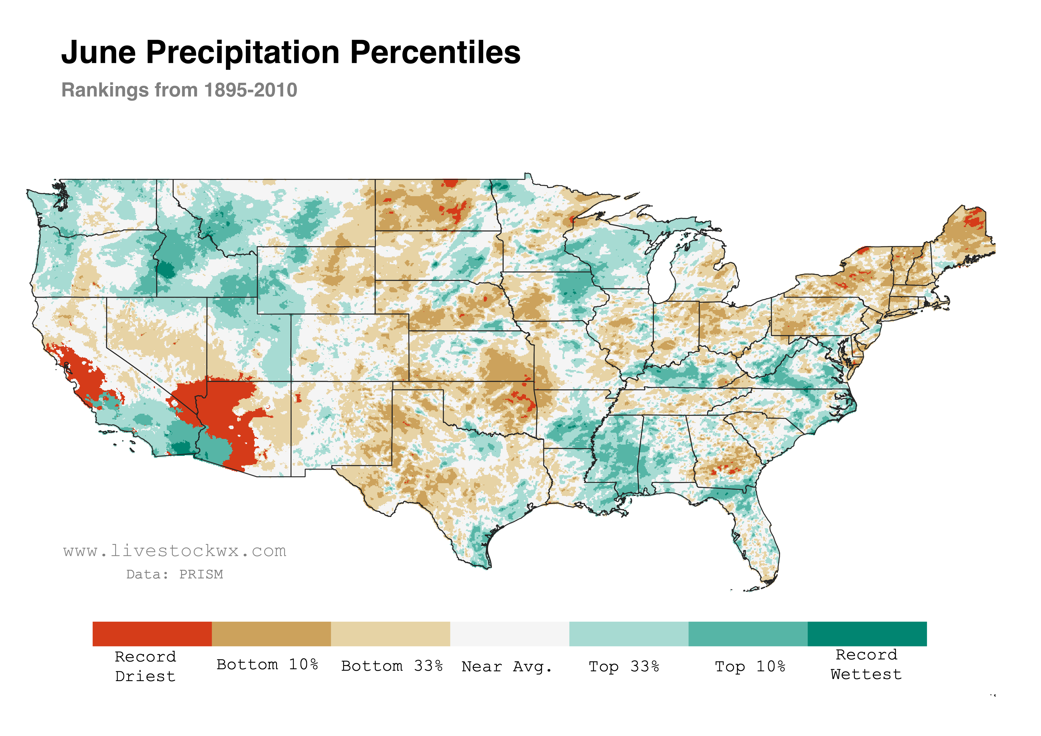
For precipitation, parts of the Pacific Northwest, Gulf Coast, and the Upper Midwest observed above normal levels. Much off cattle country, however, saw less than average totals. Northeast Oklahoma, parts of North Dakota, and New England observed their driest June on record. A large part of the Southwest and California also record low precipitation totals.
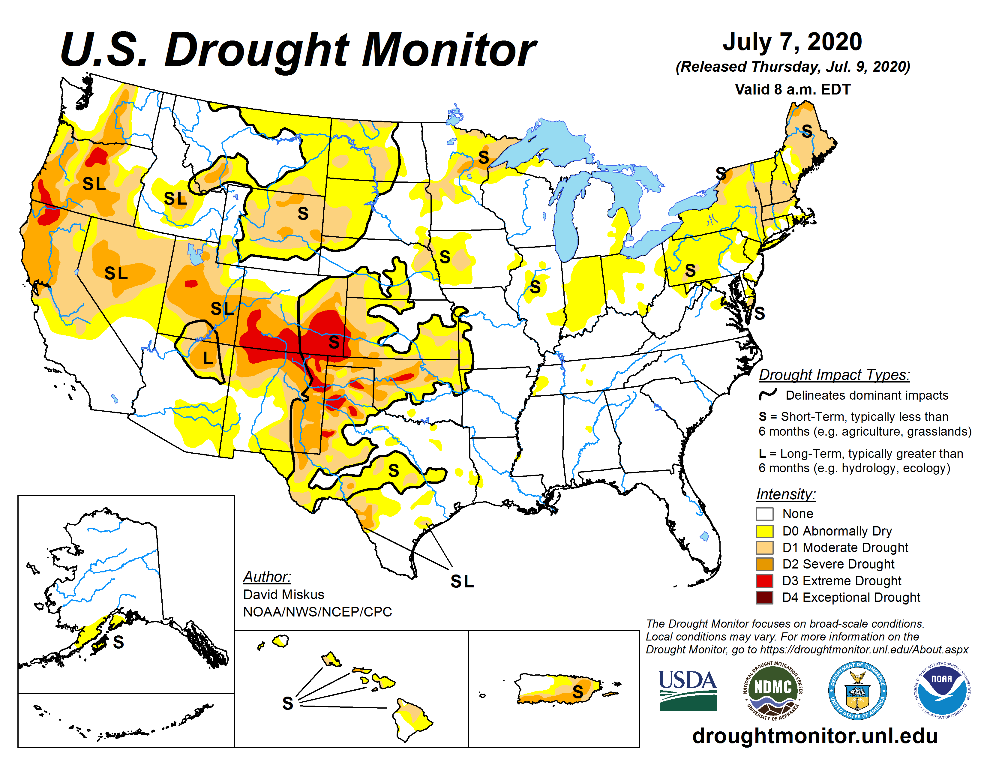
Drought Status
Unfortunately as is usual in the summer months, drought is centered across the Plains and the Western States (map at right). At present there is no D4 (Exceptional Drought), the highest drought category the U.S. Drought Monitor has, but there is plenty of D3 (Extreme Drought).
The second map below shows how drought has changed over the last month. Yellow/brown colors represent where drought has expanded and or strengthen, while green/blue indicates where drought has improved. Consistent with the June precipitation trends we see expansion of drought over the last month in Oklahoma, Kansas, and parts of the Oklahoma/Texas Panhandle. For the Northern Plains, Central Wyoming and western South Dakota have also observed a large expansion/intensification of drought. Likewise, the Northeast has observed a large part of their region in drought. Particularly hit hard is Maine.
June-July Change in Drought
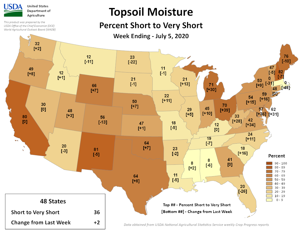
Current Topsoil Moisture
To round out the discussion, the above map shows USDA’s estimate of the percentage of topsoil considered short or very short moisture. Cattle country states trending the wrong way include Texas, Oklahoma, Kansas, Nebraska, Iowa, and Wyoming.