2019 Kansas Grazing Preview

2019 Kansas Grazing Preview

Continuing our preview of grazing, we next focus on Kansas and how this past winter and early spring will translate into grass growth for livestock producers across the state.

The unseasonably wet El Niño winter and early spring should bolster livestock grazing conditions for much of the central Plains states including Kansas.  One upside to the recently harsh winter is that we have seen fewer evaporative losses so much of the moisture we’ve received has stayed put.  Adding to the already wet conditions, climatologists and forage specialists are expecting a continuation of the cool and wet spring, which should provide the opportunity for flourishing grazing conditions.

Percent of Average Precipitation Since October 1

Evaporative Demand Since October 1

All of Kansas has had adequate rainfall/moisture since last fall. Cool temperatures during most of March, however, has slowed down plant growth.

“Cool-season grasses such as smooth brome and tall fescue are greening up and starting to grow in eastern Kansas. Some people have not been able to apply fertilizer though, because of the wet conditions. Native grasses are still dormant on most of the prairies in Kansas.  Cool-season grasses such as Kentucky bluegrass and annual bromes are greening up, especially on sites with reduced cover,” said Walter H. Fick, Ph.D., Professor of Range Management at Kansas State University; Manhattan, Kansas.   

Much Too Early Map of Areas Greening Up Based on Satellite Imagery

The below map is from the MODIS Terra Satellite and the Normalized Difference Vegetation Index or NDVI.  The average value was taken between March 16 and April 14, 2019 compared to the entire data set from 2000 to present for March – April.

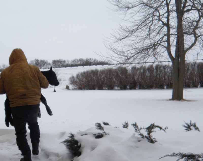
Meanwhile, many ranchers are anxious to get cattle to pasture after a long winter.   Also, with welcome recent temperatures in the 70s, the spring warmth will speed up plant growth.

“There is enough soil moisture to start grass growth, but May and June precipitation will determine the amount of forage production on rangelands in central and western Kansas,” added Fick.

Another K-State agronomist addressed winter-wheat forage production. “From the wheat perspective, this winter/fall was definitely challenging for forage production, unless the field was planted mid-September. For fields planted mid-September, there was plenty of moisture and so forage production was about on average, approximately 1300-2700 lbs dry matter/ac depending on variety,” said Romulo Pisa Lollato, Ph.D., Assistant Professor; Wheat and Forages Extension Specialist- Department of Agronomy, Kansas State University, Manhattan, Kansas.

“These early planted fields are, in the majority, already past first hollow stem and thus dual-purpose wheat producers should have already removed the cattle from wheat pastures if intending to harvest for grain,” said Lollato.  (weekly reports: https://webapp.agron.ksu.edu/agr_social/eu.throck )

Due to the amount of rain in October, 45-50% of the wheat fields in Kansas were planted late October through November, which were very limited in forage, despite good moisture conditions.  This was mostly due to the below average temperatures, and late planting.  Lollato says many of these fields are just now tillering in the spring.

That’s it for our initial check-in on Kansas.  Check back, though, as we’re just getting started and we will keep updating conditions for Kansas and the rest of cattle country in the coming weeks.

Share on facebook
Share on google
Share on twitter
Share on linkedin
Share on pinterest

2019 Texas Grazing Preview

2019 Texas Grazing Preview: Focus on the Panhandle and Rolling Plains

It’s finally April and we here at Livestock Wx are excited to finally say adios to winter and get ready for all the fun spring weather.  In anticipation of the growing season, we thought it would be good to start a grazing preview for the major cattle producing states.  This week, we’re starting with Texas and more specifically the Texas Panhandle and the Rolling Plains.  We will add more regions and states in the coming weeks.

In some ways, the Panhandle and Rolling Plains are still recovering from last year’s drought, which clung to the region from the fall 2017 through spring 2018.

“I would say a resounding yes. The Panhandle is in much better shape now than they were then. They received a good rain last week [week of: March 25th] which further reduced their drought status. (see the comparison of the U.S. Drought Monitor below)  Having said that, they can ALWAYS use more rain up there,” said Clark B. Neely, Ph.D., Assistant Professor and Extension Small Grains and Oilseed Specialist at Texas A & M AgriLife Extension.    

Portions of the High Plains (around Amarillo, Texas) began drying out during the winter months, and Neely said some cattle were pulled off of wheat fields early, from limited moisture.

2019 Drought Flip-Flop

U.S. Drought Monitor for February 12, 2019

U.S. Drought Monitor for April 9, 2019

“The state of Texas; as a whole has started to trend drier as we enter into the spring,” Neely noted, “But subsoil moisture should still be excellent in most cases, except for portions of the High Plains that were drier earlier, and now areas where drought is creeping into Southwest Texas.”   The below images show percent of average precipitation from October 1 to present and temperature departures from January to April that show the areas Neely is referring to.

Texas percent of average precipitation for October 1 – April 2019

Texas departure from average temperatures from Jan 2019 – April 2019

Looking at the precipitation by ranking from October 1 to March, we see a number of Texas Climate Divisions saw precipitation amounts that ranked in the top 100 years (out of 125).  Exceptions were primarily in South Texas.  For the Panhandle and Rolling Plains, October to March represents about 40% of the total annual precipitation so we still have a ways to go, but this is a good start.

April to July represents about 50% of annual precipitation so if the trends continues this could be a good sign for grass production this year.

Location of the 10 Texas Climate Divisions (CDs)

Plot 49

While the Panhandle has seen some late breaking rainfall, if we look at the 90-day evapotranspiration rates (the amount of moisture being evaporated from the plants and soil), we see higher than average rates in the Panhandle and Far West Texas.  Evapotranspiration rates across the Rolling Plains have been about normal to below normal.  Looking at evapotranspiration rates always completes the story even if it’s painful and checks our enthusiasm.

There is still a lot of precipitation ground to cover so this is just the beginning.

We will cover more regions of Texas next week and include another state or two from the Plains.

90-Evapotranspiration Rates (Jan-Apr) in inches (departures from the long-term average)

Share on facebook
Share on google
Share on twitter
Share on linkedin
Share on pinterest

It’s Been a Long Winter for Nebraska Cattle Producers: What’s Next?

It’s Been a Long Winter for Nebraska Cattle Producers: What’s Next?

Summary Points
Temperature Outlook
Precipitation Outlook

The most recent Seasonal or 3-Month Temperature and Precipitation Outlooks released by NOAA’s Climate Prediction Center on March 21, 2019.  The Outlooks are updated monthly on the third Thursday of the month.

Even as flood-weary Nebraska livestock producers and farmers go through the daunting task of rebuilding from the devastating losses to many farms and ranches, there are; at least some heartening signs of recovery and welcome relief.

“From a cow/calf standpoint and livestock in general, it’s been a tough winter here in Nebraska. Last fall we had moisture and it continued into the first of the year. It’s been a long winter, then on one end of the state: it was a blizzard. Then on the eastern part: rain and flooding. Now, right in the midst of calving, just finding good dry ground – has been a challenge,” said Dr. Rick Rasby, Ph.D., Associate Dean, University of Nebraska Extension; Lincoln, Neb., as Nebraska continues to rebuild after historic flooding in March after an already tumultuous El Niño winter.   Even before the blizzard and flooding, producers were challenged by how long they had to feed hay, and contend with mud, snow, low wind chills.

Rasby did say, however, there is a recent positive development, “the good thing is that FSA (Farm Service Agency) has released CRP (Conservation Reserve Program) which typically you’re not to hay or graze, but they have now opened it up, until April 30th and producers can move livestock to those areas,” said Rasby, noting that usually, those areas would be out of the mud. Much of the flooded area would be closer to river bottoms and near streams – which would not likely include CRP acres.  “After April 30th, hopefully we’ll have pastures that would be available at that time,” Rasby relayed.  Typically, cool season grasses such as brome; would start then.  “The good thing is there’s plenty of moisture, with more this week (through April 6th,) but at least we’re starting to see sunny days,” said Rasby, which will help and get grass growing.

“Also, cattlemen and women have had a heartwarming response for donations and continue to get donations to those in need. There are numerous acres of pasture and crop ground that have been covered in sand and debris from the floods, and fences have been impaired.  Cattle and acre losses are still being determined,” said Talia Goes, Communications Coordinator at Nebraska Cattlemen.

This track is favorable for the southern and central High Plains region for continued precipitation events

Al Dutcher, Nebraska Climatologist Tweet

Sloppy Conditions and the Three-Month Outlook

Nebraska Climatologist Al Dutcher explained, “This flood event was purely the result of releasing the equivalent of 1.5 to 5 inches of water into our streams/rivers in a little over 24 hours.  Put it this way, because of the frozen ground, we essentially put this much water on a concrete surface.”  Additionally, the area most directly impacted at the onset of flood conditions were locations prone to strong elevation changes, deep canyons, and had two to three foot of ice cover on waterways.  “I have heard from some that the wet soils were a factor. I say bunk on that idea.  This was just a frozen ground event with a deep snowpack that was released from a warm rain event,” said Dutcher, Associate State Climatologist at the Nebraska State Climate Office in Lincoln, Nebraska.

According to NOAA’s Climate Prediction Center and its three-month spring weather outlook (also referred to here as a 90-day Outlook), the highest probability for above-average precipitation is focused in the heart of cattle country.

The image above shows the 3-Month NOAA Precipitation Outlook for April-May-June.  The highest probability (40%-50%) of above-normal-precipitation includes a large swath of cattle country.  Counties in purple have greater than 50K head of cattle or greater.

“This will cause continued sloppy and undesirable pen conditions. We’re also in the midst of calving for a lot of cattlemen and women, and those who are calving outside are calving in mud. This is a concern when it comes to the health of the animal,” said Goes.  Dutcher confirmed there could potentially be a wet spring in the Cornhusker state and in the central Plains, as well as the possibility of the El Nino season lingering past its original end date.

“Precipitation forecasts indicate that wet conditions are likely, with the highest odds assigned to southern Texas, Iowa, and the western interior from central/northern California eastward into the Great Basin.  El Niño conditions are in play, and the strong surge of warm water is now making its way to the surface in the eastern Equatorial Pacific,” said Dutcher.  “This should help continue to move water vapor northward and interact with weather systems undercutting the Gulf of Alaska ridge,” he added. 

These weather systems have been entering the U.S. from northern to southern California, then head east/northeast. This track is favorable for the southern and central High Plains region for continued precipitation events, but also signifies less Arctic air intruding into the region and tilts the odds slightly to the above-normal temperature category. 

“Caution though; 90-day outlooks really rely on the atmospheric pattern when the forecast is made [the third Thursday of each month or in this case March 21st]” Dutcher said.  Dutcher went on to say, “the latest monthly [temperature] forecast…is completely different than it was in mid-March [for the three-month or 90-day forecast]”. “The temperature forecast went from below normal from Texas north through South Dakota to above normal temperatures [in the monthly outlook] nationwide outside of the extreme southern Plains,” said Dutcher.  “Therefore, when a significant pattern change [is observed] in the same map 10 days apart, you know that a strong pattern change has occurred. Since this one went from cold to warm, it should make the 90-day outlook issued 10 days ago suspect,” said Dutcher. 

The image above shows the 3-Month NOAA Temperature Outlook compared to the 30-Day Temperature Anomaly Forecast.  The two outlooks/forecasts were issued approximately two weeks apart. The 3-Month or Seasonal Outlook is showing expected conditions over a three month period and is not directly comparable to a 30-day forecast.  The point to take from the comparison, however, is that the models are likely seeing a pattern change that had the longer outlook been released later could’ve made it shower warmer conditions.

A conference call with UNL Extension call Tuesday, April 2nd indicated some damages to low ground in Nebraska.  “We know that,” said Dutcher, “But, surprisingly, a lot of our educators indicated soil erosion wasn’t too bad (the ground froze), but secondary roads (logistics) may be the biggest factor going forward.” Dutcher said soil temperatures taken during the morning of April 2nd at the four-inch bare soil depth were 33-45 F (coldest north, warmest south).

“Cool season grasses are beginning to grow in Lincoln (Nebraska.) The northern one-third of the state still had frost in the ground from 8-18 inches (above and below that were frost free),” said Dutcher.   These wet soils will warm slower, but at least the outlook looks warm for the next two weeks minimum, with widespread temperatures in the 70s next week across the central and southern Plains (and indications of some 80’s).

There’s more encouraging news for Nebraska farmers and ranchers.  “Not one Educator mentioned [lack of] oxygen levels. So, the biggest issue outside of severe flood prone areas is that fall catchup activities need to be addressed, but from a planting perspective, soil temperatures aren’t really too out of line.  As long as temperatures remain above normal, planting delays will be moisture related, not soil temperature related.  Personally, I think that the acreage in Nebraska that doesn’t get planted will be much smaller than folks think,” said Dutcher.  That’s potentially good news and with the more recent NOAA 30-day forecast showing warming conditions could be on the way, livestock producers may have something to look forward to.

Share on facebook
Share on google
Share on twitter
Share on linkedin
Share on pinterest

Calving in an El Niño Winter

Calving in an El Niño Winter

When a shivering cold and wet, wide-eyed baby calf was born on an unusually frigid El Nino Kansas evening in late February 2019, the resulting turn of events were proof that miracles happen but can’t be taken for granted. Right on the heels of this calf (named ‘Laurie-Bell’) coming into this world, El Niño’s peak onslaught arrived; heaving a relentless stream of bone-chilling, frosty nights and days from late February into March.

For heifers and even seasoned cows, delivering their newborns this season became especially daunting when compounded by an unsympathetic Arctic airmass that thrust single digit temperatures and a piercing north wind through two-foot snow drifts covering many Midwestern farms.

Larry Hadachek carries a newborn calf after being warmed and fed, Republic County Kansas. Photo credit: Amy G. Hadachek

“This winter has been the result of a triad of weather features: an emerging El Niño, a weak Arctic Oscillation, and an active Madden Julian (pattern,)” explained Mary Knapp; Assistant State Climatologist, located at Kansas State University in Manhattan, Kansas.

“The emerging El Niño favors wetter than normal conditions. The weak Arctic Oscillation favors repeated polar vortex – with incursion of cold Arctic air into the Plains. The active Madden-Julian results in frequent storms making their way across the U.S.  As these continue, stress on livestock, and those caring for them also continues,” added Knapp.

In the case of the chilled calf ‘Laurie-Bell’ – she was quickly dried and warmed with an oversize bath towel and a home-quality blow dryer.  Warming the calf’s body first was vital, followed by extensively warming its wet fur clad to its’ hooves.


While sadly at first, this calf’s new momma, didn’t immediately ‘claim’ her newborn through the typical, critical initial physical and emotional attachment, the baby calf in this case was able to get a jump-start in life when fourth-generation farmer/rancher Larry Hadachek; Cuba, Kansas quickly warmed up the calf, and fed it – a colostrum ‘protein shake’ using an esophageal tube, to be sure nutrients made it past a loud, unyielding mouth and down the calf’s left side, into its stomach.

“Sometimes she doesn’t realize that’s her calf, if humans are helping and using a puller.  She’s having to strain to get the calf out, and what she may be thinking – is that she’s in pain, and she may be blaming the calf for the pain.  That’s why you have to shut them up; momma and newborn together alone.  You don’t want to turn them out on their own, because she could just walk off, if they haven’t bonded,” said Hadachek.

2018-2019 Winter

The National Weather Service notes – high winds, freezing rain or sleet, heavy snowfall, and dangerously cold temperatures are the main hazards associated with winter storms, as well as slick roads from ice or snow buildup which can result in vehicle accidents.  The severely cold temperatures and wind chills during and after a winter storm can lead to hypothermia and kill anyone caught outside for too long.  As ranchers know all too well, this potent El Niño season has hit precariously hard for humans and animals. Farmer/rancher Claygatt Shulda, of Republic County, Kansas, agrees – this El Niño winter ranks as the most difficult calving season he remembers.

“I’ve been doing this for over 45 years, and this is the worst winter so far, I think with the extreme cold, and all the moisture and snow,” said Shulda who has a mostly Red Angus cow-calf herd. Clay’s wife Connie Shulda says it’s been a brutal El Niño winter.

“My husband pretty much sleeps in his recliner in his clothes and his coveralls so he can get up every two hours and check on calves.  He’s been doing this non-stop from February 1st through March 8th,” said Connie, who’s also a full-time nurse.

For heifers and even seasoned cows, delivering their newborns this season became especially daunting when compounded by an unsympathetic Arctic airmass that thrust single digit temperatures and a piercing north wind through two-foot snow drifts covering many Midwestern farms.

A newborn calf brought inside to get warm and fed colostrum earlier this month in Republic County, Kansas. Photo credit: A.G. Hadachek

Keep Those Calves Warm

A Nebraska extension specialist says keeping the calf with its momma, is always the best choice – otherwise, a rancher needs to intervene to be sure the calf warms up and eats.

“It is best if they suck rather than having to be intubated and they won’t suck if they are cold, so warm first,” said Karla Jenkins, Cow Calf, Stocker Management Specialist/University of Nebraska-Lincoln at the Panhandle Research and Extension Center in Scottsbluff, Nebraska.  “If a barn is not an option, then getting them dry and warmed up in the house is recommended; probably a warm bath followed by a blow dryer and heat lamps. Once returned to momma, providing a windbreak and bedding is the best you can do if you don’t have a barn,” said Jenkins.  Heating mats are also available at farm stores to warm up the calf from bottom side-up.  Other choices: hot boxes; a small room or box that has heat or heat lamps.  It’s vital to feed colostrum as soon as possible.

“Cold calves can’t absorb colostrum effectively.  Provide them some warm fluid (electrolyte) to warm the insides first while using other methods to warm the outside.  Then provide colostrum,” recommends Sandy Johnson, Ph.D., Extension Beef Specialist/Northwest Research and Extension Center; Colby, Kansas.

Feeding Newborn Calves

Vital Steps for Newborn Calves in The Unseasonably Cold El Nino Winter

Even as El Niño’s winter stronghold plays tug-of-war with ranchers in this critical calving season, beef specialists in the nation’s heartland are urging cattle producers to take specific critical steps when handling a shivering, cold, wet newborn calf – when its momma doesn’t ‘claim’ it.
If the mother’s there – she will handle it. It also helps to have some ‘calf claim’ to sprinkle on the calf, as it attracts the mother to lick it and help them bond. However, when a rancher needs to intervene in this case, it’s vital to:

1. WARM the Newborn Calf

Immediately warm-up the calf, with a towel and/or blow-dryer, a heating mat, warm room, or even a warm pick-up truck.  Also-have colostrum on hand, and immediately mix a package with warm water.

2. The Safe Way to Feed A Newborn Calf

“If you have a calf unable to sit up, you can feed with an esophageal tube down its left side, which should correctly get in to the stomach. If they lay flat, however, there’s a high probability fluid could come up and aspirate into the lungs where you don’t want it to go!” cautioned Dr. Rick Holloway, DVM., Animal Clinic in Belleville, Kansas. “So, after you feed the calf, its strongly recommended you keep them propped up. I would never let a calf lay on its side after I ‘tubed’ them. I always make sure they’re sitting upright for at least a couple of hours,” advised Dr. Holloway. “Otherwise, that liquid goes into the respiratory tract, and they get ‘aspiration pneumonia,’ and… they literally drown.”

Dr. Holloway says if a producer has a calf who can hold its head up and can lay on its sternum (breastbone-at the front center of the chest,) then – “You won’t have problems with ‘aspiration pneumonia.’ But if you have a calf who cannot hold its head up, or on its’ sternum…they need to be propped up,” said Dr. Holloway, adding, “You have to take your precautions.”
The intensely frigid, snow and wind chills can chill the calf; causing a negative start to its young life. “When they’re that cold, everything works at a much slower pace,” noted Dr. Holloway.
Prop them up…and here are a few ways to do that…

3. Ways to Prop-Up the Newborn Calf

“You can use a bale to prop them up, and we’ve even used a foot and a half railroad tie. Also, if they’re not flopping around, putting their legs in the right place can work,” said Dr. Holloway.

Another veterinarian also agrees – properly feeding and warming are paramount.  “Whatever it takes to get them warmed up – so they’re not hypothermic.  It can be on the floor of a pickup or hot box, whatever to warm them up. Warm the extremities too (legs;) the whole body, and get that colostrum in soon as you can,” said Gregg Hanzlicek, DVM, Ph.D., Veterinarian at Kansas State Veterinary Diagnostic Laboratory at Kansas State University; Manhattan, Kansas. “If you’re using the tube, it’s important that they’re standing up between your knees, to prop them up between your feet, just so they’re lying on their sternum. Absolutely do NOT ever give colostrum when they’re lying on their side,” advised Dr. Hanzlicek.

4. How to be sure the esophageal tube is correctly administered

“Look on the calf’s left side of its neck and if you can see, or feel the tube past their jaw you’re doing it correctly. If not, start over,” advised Dr. Hanzlicek.
Otherwise, Dr. Hanzlicek warns, you’ve put it on the OTHER side, and you’ve drowned them. “The tube needs to go into the esophagus and not the trachea. If you can feel the tube slide past your fingers (on that left side) you’re okay.”
Within the first two hours after birth, it’s critical to get the colostrum into the newborn calf because their ability to absorb it, decreases with age.

5. Give the entire two quarts of colostrum and warm it up

“You have to get the whole two quarts in; because it contains the minimum amount of antibodies they need. Also, be sure to warm the colostrum so that you’re also warming up the internal organs,” advised Dr. Hanzlicek, noting, “It’s fine to dry the calf while you’re feeding him/or her. That colostrum needs to be provided, immediately.”
While the bulk of the intense cold is slowly waning and morphing into spring…as Dr. Holloway put it, “Now we’re fighting the mud…”

If the cow won’t/can’t get the calf dry initially, the producer can also warm it on the floor of the pickup, or through other options. If calf is chilled, use a thermometer to monitor calf warming progress,” said Johnson.  Heated calf boxes need to be kept clean, as too much moist air in the box can create a new problem; pneumonia. “It’s best if there are bedded areas that calves can access with no cows. If there’s no overhead shelter, bed heavily.  If the only semi-dry area for calves to lay down is next to a bale feeder, calves will find it and are at high risk for injury,” cautioned Johnson.  That’s because cows gathered there to eat, could step on a little calf.

A veterinarian who oversees a livestock program with the University of Nebraska-Lincoln said this winter ranks high on the list of challenging winters which stressed late gestating cows, as well as calves being born.

“It’s a year where good calf vigor is at a premium, meaning calves that are really strong and can bounce up – have an edge opposed to calves who don’t.  We know that cows that are in higher levels of body condition (5 or above) will tend to have calves who get up and nurse faster.  We know that calves born without calving difficulty, can get up quicker,” said Dale Grotelueschen, DVM, Director of the Great Plains Veterinary Educational Center, UNL; located at Clay Center, Nebraska.

Grotelueschen says it’s important to just be there and get that calf moved to a warm environment.  “You just need to get the core body temperature warmed up and continue to warm them until the extremities (legs) warm up. You can also use a rectal thermometer to monitor how well you’re doing on your warm-ups,” he added, noting this winter has been a grim reminder how important those things are.

Additionally, since any chilled calves are obviously stressed, being chilled can result in lower levels of colostral absorption.  “So, even though we give them enough, they may not absorb the colostral protein as well as if they weren’t chilled, so that’s a complication we need to monitor, because we know that calves which have compromised colostral absorption, are at greater risk of scours and pneumonia,” cautioned Grotelueschen.

For heifers and even seasoned cows, delivering their newborns this season became especially daunting when compounded by an unsympathetic Arctic airmass that thrust single digit temperatures and a piercing north wind through two-foot snow drifts covering many Midwestern farms.

Spring Outlook

Even with some recent melting, early spring doesn’t guarantee the end of a cold El Niño period.  The spring 2019 Outlook from the Climate Prediction Center forecasts above normal precipitation through March for the southern half of the U.S.; east of Nevada. Temperatures in the Plains states and the Rockies have an equal chance of either normal, above or below normal temperatures.  Any melting of the record-heavy snow creates a muddy mess for cows giving birth to newborns in the mud and the muck.  That’s when additional bedding is recommended.

Another concern, forecasts of moderate to heavy rain in March and possibly April.  Near rivers, flooding is another concern.

While the CPC April outlook keeps predictions largely cooler and wetter than normal, there is hope.

“For what it’s worth, normal highs in Manhattan, Kansas, for example, at this time are 56F, by the 1st of April that jumps to 62F,” Knapp observed.

Meanwhile, remaining vigilant alongside ‘mother nature’ is paramount.  As Clay and other ranchers learned this challenging calving season, “Just stay after it.  We just try to keep an eye on it all”.

April-May-June Seasonal Outlook

Temperature Outlook

Precipitation Outlook

The three-month Seasonal Outlook released by NOAA’s Climate Prediction Center on March 21, 2019. Purple indicated counties with 50 thousand head of cattle or greater. The Outlooks show spring conditions could continue to be difficult for cattle producers in the middle of calving.
Share on facebook
Share on google
Share on twitter
Share on linkedin
Share on pinterest

Flooding Nebraska

Flooding Nebraska

As Nebraskans awaited a visit from Vice President Mike Pence Tuesday; March 19th, to tour the state’s flood-ravaged areas, state officials shared some improvements in the impact on Nebraska highways, as well as plans in-progress to speed up the application for federal disaster aid. 

Although 79 highways had been closed at the peak of flooding in mid-March, with over 1500 miles of highways, that number is now down to 540 miles closed.  However, there are 200 miles of pavement that will require significant investment.  “We now expect transportation damage in the hundreds of millions of dollars,” said Nebraska Department of Transportation Director Kyle Schneweis.

Significant flooding is already occurring around thin the Upper Midwest and is having large impacts to cattle producers in those states. The map show NOAA's Flood Outlook for Mar 22-Mar 27th. Image: Livestock Wx Analytics

A whopping two-thirds of Nebraska counties have now been declared disaster areas.  s of March 18th, Nebraska Governor Pete Ricketts had declared 65 counties, 74 cities and four tribal lands as disaster areas. We have never had this impact.  We’re working as quickly as possible into the recovery process.  As flood waters go down, be safe before you go in any homes,” cautioned Nebraska Governor Pete Ricketts, as he was joined in a ‘live’ conference call on Monday, March 18th by Nebraska National Guard Adjutant General Daryl Bohac, Nebraska Emergency Management Agency Assistant Director Bryan Tuma, Nebraska Department of Transportation Director Kyle Schneweis, Nebraska State Patrol Colonel John Bolduc, and Nebraska Department of Agriculture Director Steve Wellman.

Officials also announced on the conference call, that they were expediting the process for getting a federal major disaster declaration. 

“They’re reviewing our federal disaster aid request now at the (FEMA) regional office,” said Bryan Tuma, Nebraska Emergency Management Agency Assistant Director.

29 counties had mandatory evacuations, 18 counties let people return, six counties are not letting people back due to hazards, Tuma said.  He’s also hoping to help replace tired local responders.

Nine shelters are being operated by the American Red Cross, with 474 individuals using them.  The Red Cross has served nearly 4,000 meals - which have all been appreciated by weary, but thankful faces.

"The river is just now cresting and will probably be in record flood for the entire week [through March 23]”

Scott Van DeWald, National Weather Service Tweet

With some floodwaters receding in the aftermath of historic flooding engulfing east-central Nebraska, southeast Nebraska, central and north-central parts of the state, a monstrous El Niño winter season and recent ‘bomb cyclone’ storm dragging an intense low pressure system are blamed for three flood-related deaths, two missing persons, evacuation of homes, bridges pulled apart, roads washed out, a flooded church condemned and sewage back-ups.  With snow and ice continuing to melt in warmer temperatures, more flooding is expected at least through Friday, March 22nd, and possibly beyond. Flooding along the Missouri River (east central Nebraska) is expected all week.

Officials confirmed three people died in the flooding; and a fourth person is missing.  In Norfolk, Nebraska, a man died after driving his car into floodwaters.  When a farmer near Columbus attempted to rescue a neighbor, his tractor went into a hole and flipped, killing him. Rescue officials were unable to get to an 80-year old Columbus woman because of flooding, and she died.

To date, 163 people have been rescued by Nebraska State Patrol.  Another 111 people were rescued by the National Guard, and 16 saved by Urban Search and Rescue. 

“On the livestock sector, the death loss from flooding and the blizzard, and sick animals needing care, and rebuilding damage has reached $400-million dollars of impact directly to the livestock sector; mostly to the beef sector,” said Steve Wellman, Director; Nebraska Department of Agriculture.  Concerning the number of farm acres now unusable from flood damage, “We haven’t tried to accumulate that, at this point. We’ve tried to assess damage. However, for spring planting and field preparation, obviously there will be delays there, but its hard to know now, what that amounts to,” said Wellman.  “We continue being in contact with our farming agencies.”

The Department of Agriculture has started a hotline:  1-800-831-0550  “Our goal with that hotline is to receive calls from farmers and ranchers regarding what they need to continue with their operations, and to receive offers of supplies and help.  Today, 2/3rd of the calls we received offered supplies and help.  We’re very thankful for the response for those offering help to our farmers and ranchers,” said Wellman. “This all has an impact when dealing with this daily, either on homes or farms and ranches…and so for anyone experiencing stress and needing to reach out: call: 800-464-0258.

March-May 2019 Spring Flood Outlook recently released by NOAA.

Downstream from Omaha is still in moderate flood, and then it’s in record flood territory.  “The river is just now cresting and will probably be in record flood for the entire week (through March 23,)” said Van DeWald, lead meteorologist with the NWS Omaha office, which also flooded when the dike failed Friday morning.  “Our (National Weather Service) office is a couple of miles from the Platte River, and our office had an hour to shutdown everything, move equipment up on desks and get out of the building,” said DeWald.  Some of the forecasters are working out of the Hastings NWS office; issuing alerts and forecasts.

     While water is receding, the bad news is – it’s revealing a lot of damage. “We don’t have widespread reports of looting, but we’ve received calls with suspicious activity, and we have zero tolerance for anyone coming into these damage areas – those people will get our full attention with law enforcement,” said Colonel Bolduc. 

      The National Weather Service has issued its 2019 Spring Flood Outlook for eastern Nebraska and western Iowa, and unfortunately, for much of that area, there is a much-above-normal risk for minor and moderate flooding this spring; largely the result of high soil moisture, elevated river levels and an increasing snowpack.

For those wanting to help or donate, officials are recommending contacting the American Red Cross:  www.Redcross.org to donate time, money, blood donations.                          

Share on facebook
Share on google
Share on twitter
Share on linkedin
Share on pinterest